Top Drone
Navigation
  • Services
    • DRONE FILMING & PHOTOGRAPHY
    • REAL ESTATE & PROPERTY MARKETING
    • DRONE MAPPING | 3D MODELING
    • CONSTRUCTION PROGRESSION
    • DRONE INSPECTION & SURVEYING
    • TOURISM, EVENTS & BRAND PROMO
    • FPV DRONE FILMING
    • GROUND FILMING & PHOTOGRAPHY
  • Portfolio
    • DRONE VIDEOGRAPHY
    • DRONE PHOTOGRAPHY
  • SHOP
  • Contact Us
  • Blog
  • ABOUT US
  •  

Post Archive by Month

Below you'll find a list of all posts from October, 2017

Thermal image over houses

Thermal Imaging Drone

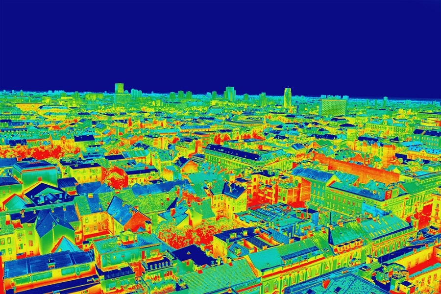
Thermal Imaging Drone Cameras The use of thermal imaging drone is nothing new. Although these days with the falling price of drones in general,  a thermal imaging drone can be …

Read More
thermal imagingthermal imaging drone

3D Drone Mapping

3D Drone Mapping What is 3D Drone Mapping you may be wondering? Wonder no more friend, read and learn. First, as well as a capable drone, you will need software …

Read More
3d mappingdrone mapping

Police using Drones for Surveillance

Big brother is watching, Police using Drones for Surveillance This is nothing new but more and more police forces are using drones for surveillance. Yet another tool for the law …

Read More
drone surveillancePolice drones
From Ground to Sky Your Story Captured
We use cookies to ensure that we give you the best experience on our website. If you continue to use this site we will assume that you are happy with it.